
Walk : Haycock (2,618
ft) & Caw Fell (2,288 ft) from Bowness Knott, Ennerdale
Date : 22nd June
2021
Weather : Sunny, dry @
17°C
Distance : 9
miles round trip
Time Taken : 2 hours 30
mins to first summit (Haycock)
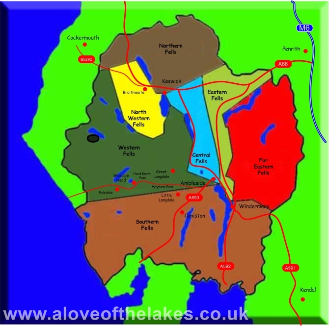
Which
part of Lakeland is this walk situated
Terrain Overview

Overview
A
lovely walk that takes in the beauty of Ennerdale
Water. The path that
climbs steadily up the flank of Silver Cove is initially a little tricky
to find largely due to the amount of
deforestation work that is currently going on, but once located leads
unerringly to the ridge that connects
Caw Fell and
Haycock. Unbelievable views throughout

The walk starts
a Bowness Knott car park which is free to use. The
main track that runs down the side of Ennerdale Water
has restricted
access to the general public, being largely the
domain of Forestry Commission and MRT vehicles only

Looking across Ennerdale Water to Crag Fell from the car park

From the car
park turn left and follow the private road down the side of the lake

After about a
mile of level walking turn right to take the bridge that crosses the River Liza

Crossing the
River Liza

Looking across
to Pillar

Across the river
and the intended route of the day (highlighted) shows the steady climb up to
the ridge line that connects Caw Fell and
Haycock. At the end of this track turn left
through the hand gate

The path leads
to a footbridge that crosses Silvercove Beck

Cross the bridge
and turn left

The stone path
is only followed for a short while before taking a right turn in to the wooded
area to follow a wide forest track

Take a right
turn here and keep right to access the forest track

Following the
forest track

Within a third
of a mile along the track keep a lookout on the right for a small wooden bridge
that crosses Silvercove Beck

Crossing the
small footbridge

Silvercove
Beck. Once across the bridge make a left turn

Following the
track that climbs steadily through the wooded area

The track
emerges the woods and leads to a sty over the fence that gives access to the
open fell side. Follow the track left

The track up to
the ridge line is now all ahead of you and is easy to follow even in mist.
There are marker

Approaching the
ridge line with Little Gowder Crag on the left

Looking across
to Scoat Fell and Steeple (the pointy bit) from the
track

Just as the
track starts to bend right its time to branch off left at any convenient point
and make the short journey across grass to the fence line

The
fence line that connects both summits of Caw Fell and Haycock. At this point its
just a case of deciding which fell to do first
left to Haycock and right to Caw Fell

We take the left
route to do Haycock first. Its worth crossing over the
wall line so that you can walk past the right hand side of Little Gowder Crag

Approaching
Little Gowder Crag

Past
the Crag now and the terrain changes from grass to a boulder highway. Keep following the line of the wall

The views really
start to open up from here. Sue takes in the views over Ennerdale
Water towards Great Bourne and Starling Dodd

Approaching one
of the summit

Sue on the
summit of Haycock - Click here for a 360 degree view … https://youtu.be/VLA-Kh3BBl0

The connecting
ridge to Scoat Fell and Steeple beyond

Looking towards

Looking over to Seatallan, Middle Fell, Whin Rigg and Illgill Head from the
summit

Such a joy to be
up on the fells today

We take the path
back down to Little Gowder Crag to journey to Caw
Fell.

Looking over
towards the High Stile, Red Pike ridge line fro the path to Caw Fell

Crossing the
wall to follow the grass track up to Caw Fell

No navigation
issues to get to Caw Fell summit just follow the wall line

The summit of
Caw Fell – Click here for a 360 degree view … https://youtu.be/MBH_nH8tvSc

Grasmoor
peeping up behind the Red Pike, High Stile, High Crag ridge line

Steeple and Scoat Fell

Early evening
back down at Ennerdale Water and the end of another
fantastic day in
Copyright © aloveofthelakes.co.uk 2011 -
2020